Unit Objectives
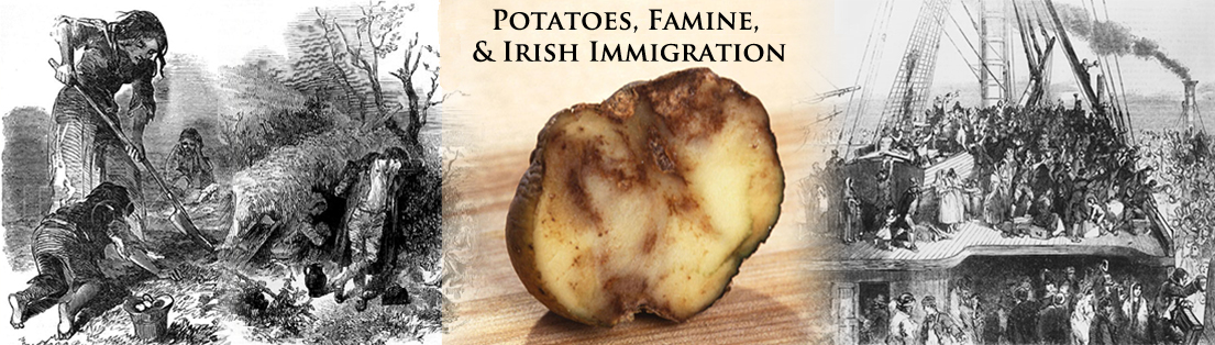
| • | Understand the historical, cultural, and economic impact of the failure of the potato crop in Ireland in the late 1840s and early 1850s. |
| • | Compare and contrast both public and private efforts to deal with the effects of the Great Irish Potato Famine. |
| • | Use primary documents to understand the emigration and immigration experiences of Irish who migrated to the United States. |
| • | Use GIS software to analyze and interpret factors related to demographic changes in both Ireland and the United States resulting from the potato famine. |
Related National Standards
|
Common Core standards apply to the
activities in this unit.
Identify those that are appropriate to the particular materials you select to use from this set of history related standards compiled as part of the American Social History Project City University of New York. |
||
|
|
|
|

|
GIS investigations are part of many of the activities in this unit. These investigations make use of ArcGIS Online, an internet software that runs on most browsers. If you do not have an an ArcGIS account and would like to have one you can sign up for a free personal account here. The Irish Famine Project files are also available to download for ArcGIS Desktop.
Download
Irish Famine Project Data
|
The data and shapefiles in the various map layers are from a variety of sources:
Layer |
Source |
|---|---|
| Irish Cities |
Population data from Irish Counties Census Statistics 1841-1851, The Irish Quarterly Review, Volume1, No. III, September, 1851, pp 507-522 as found at Irish Emigration Database. |
| Ireland - Counties County Wicklow County Mayo |
Irish county and electoral division shapefiles from Fotheringham, A.S., Kelly M. and Treacy C. (2011) NCG Online Atlas Portal: Irish Famine Data Atlas Famine related data from: Fotheringham, A.S., Kelly M. and Treacy C. (2011)
NCG Online Atlas Portal: Irish Famine Data Atlas |
| Fitzwilliams Estates |
Shapefile based on map and description in Jim Rees, Surplus People: The Fitzwilliam Clearances 1847-1856, (Cork, Ireland: The Collins Press, 2000). |
| United States |
United States shape files and census data from Minnesota Population Center. National Historical Geographic Information System: Version 2.0. Minneapolis, MN: University of Minnesota 2011. |
| Massachusetts |
Massachusetts 1860 census data and shapefile from Minnesota Population Center. National Historical Geographic Information System: Version 2.0. Minneapolis, MN: University of Minnesota 2011. Abstract of the Census of Massachusetts 1860 from the Eighth U.S. Census, Boston: Wright & Potter, State Printers, 1863, p 124. |
| John Crowley, William J. Smyth, & Mike Murphy, editors. Atlas of the Great Irish Famine. New York: New York University Press, 2012. |
| Colm Toibin & Diarmaid Ferriter, The Irish Famine: A Documentary. New York: St. Martin's Press, 2001. |
| James S. Donnelly Jr., The Great Irish Potato Famine, Gloucestershire: The History Press, 2012. |
| Steve Taylor, editor. Views of the Famine: Contemporary newspaper articles and illustrations from the Great Hunger in Ireland, 1845-52 |
| Mayo County Library, The Famine in Mayo 1845 - 1850. |
Your comments and suggestion about these materials are more than welcome.
If you have ideas for additional topics that would lend themselves to the approach taken here, please pass them along. I'd enjoy collaborating with you.
| email: |
Last modified in May, 2015 by Rick Thomas