Title

Map It

Hetch Hetchy is located in Yosemite National Park in the Sierra Nevada Mountains of California. Zoom in on the map below for a more detailed view.

California

Yosemite

Hetch Hetchy

To Start You Thinking -

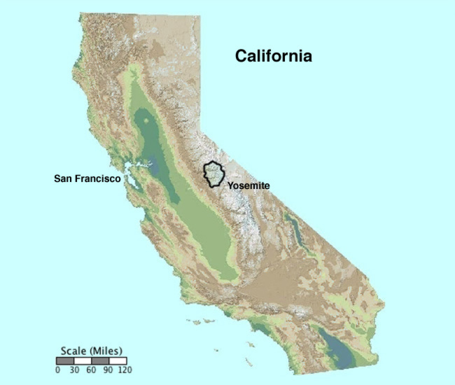
1) Hetch Hetchy Valley is located in the northwest corner of Yosemite National Park. Approximately how far is it to San Francisco?

2) Click to open the map of Yosemite. Notice that Yosemite Valley and Hetch Hetchy Valley nearly parallel one another. Describe the location of Hetch Hetchy Valley in relation to Yosemite Valley. Use the map scale and compare the length of the two valleys.

3) Click to open the Hetch Hetchy topographic map. Each of the lighter contour lines represents 100 feet of elevation change; the darker lines 500 feet. Approximately how high is the cliff on either side of Wapamma Falls above the lake? Describe the topography at the east end of the lake.


maps from "California State and County shape files" from ESRI Data & Maps available in My World US data files


“Boundary of Yosemite National Park, California,” from the National Park Service Geography and Mapping Technologies, Geographic Information Systems web page.
"Yosemite Area" clipped from “30m Color Hillshade of California,” from CaSIL - The California Spatial Information Library.


“Topographic map of Yosemite National Park, California / from Geological Survey maps surveyed between 1893 and 1909,” available from the American Geographical Society Library at the University of Wisconsin-Milwaukee Libraries.

Last modified in January, 2011 by Rick Thomas