Title


A Place Portrait

To begin to understand the dust bowl of the 1930s in the Great Plains you need to understand the place. In the exercise below you will be presented with a series of written and visual images of the region and asked to pull these pieces of evidence together to form your own portrait of the region. You will then be asked to gather more traditional geographic information and compare and contrast the images you form using each type of data - achieving in the process a rich place portrait.

1) The list below includes a variety of perspectives of the Great Plains. As you study each description follow the example given in your Place Portrait worksheet and take notes about the mental images formed by the details of each source . When you are done pull your notes together and write your own brief word portrait of the Great Plains.

My Antonia

Sod House

The Platte and the Desert

Giants in the Earth

Hunting of the Plains

Dakota Land

Turf House on the Plains

Ranch Life and Hunting

2) You have a number of geographic resources at your disposal including these on the internet:

The National Geographic Map Machine

The Color Landform Atlas of the US

The Weather Underground

National Climate Data Center

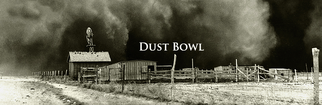
Google Earth can be used to view satelite images of the Great Plains. And atlases from a library are an excellent resource.

Use these resources and pull together geographic data about the Great Plains that you can attach to your Worksheet. Include information about:

  • • the physical geography,

  • • landforms, and

  • • climate

3) Compare and contrast the image formed in your mind by each type of data - the written and picture descriptions on one hand from #1 and the more traditional geographic data on the other from #2.

Last modified in October, 2011 by Rick Thomas